The City of Albuquerque is located in the middle of the state of New Mexico and straddles the Rio Grande, which flows south from the Rocky Mountains of southern Colorado to the deserts of Texas where it becomes the boundary between the US and Mexico. It is a large city with a population of about 900,000 in the greater metropolitan area. Just under 700,000 people live in Bernalillo County, which includes the incorporated area of the city.
Albuquerque is located at the northern edge of the Chihuahuan desert at elevations ranging from 5,000 feet at the river to nearly 11,000 feet at the crest of the Sandia Mountains, 15 miles to the east. The climate is characterized as semi-arid with annual precipitation ranging from about 9 inches per year near the river to 20 inches per year at the top of the mountains. Approximately half of this precipitation is from thunderstorms which occur during the monsoon season between July and September. Summer thunderstorms often have rain intensities exceeding 2 inches per hour, though usually, the duration of these storms is an hour or less. These storms and the steep watersheds produce runoff events with very sharp hydrographs that sometimes mimic the flash floods depicted in old western movies in which a wall of water races down a dry channel, carrying away everything in its path.
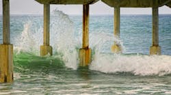
The inner valley of the Rio Grande consists of an ancestral flood plain that is 1 to 3 miles wide and very flat with slopes typically less than 1 foot per mile. However, most of the city’s urban development is on uplands east and west of the inner valley with average slopes ranging from 1% to 5%. The upland soils primarily consist of loose sands and silts with little natural vegetative cover and are therefore highly erodible. Due to the steep slopes, the infrequent but intense storm events, and high erosion potential, most stormwater conveyance structures built 20 or more years ago consist of steep, straight, concrete-lined trapezoidal channels called arroyos in the local vernacular. Supercritical flows occur in most of the lined arroyos with velocities that, at some locations, can exceed 30 miles per hour.
The older concrete arroyos are unattractive except maybe to civil engineers and skateboarders. They are costly to build and maintain, and the flashy nature of summer storms and very high velocities in the channels present significant dangers to the public. Flash floods even introduce hazards to maintenance crews who, though they are well informed of the threat, sometimes can’t get their equipment out of the channel before it is washed away by a wall of water.
The old concrete-lined arroyos were designed and built in an era when the principal objective of stormwater management was to get the water off the watershed and to the river as quickly as possible. Current stormwater management practice recognizes the benefits of slowing the water down in upstream detention basins and allowing it to flow through unlined or soft lined naturalistic sand bottom channels. The benefits of spreading out the hydrograph include reducing the size needed for the channels, reducing the water’s erosion potential, allowing infiltration to replenish underlying aquifers, and improving stormwater quality by enabling capture of floatables and removing suspended and bedload sediments.
Stormwater Management
Stormwater near Albuquerque is principally managed by three cooperating agencies. The City of Albuquerque manages most of the storm sewers within the city limits, Bernalillo County has primary responsibility for smaller structures and channels in the unincorporated parts of the county, and the Albuquerque Metropolitan Arroyo Flood Control Authority (AMAFCA) is responsible for most of the large arroyos and the flood control dams and ponds in both the incorporated and unincorporated parts of the community. Because of the overlapping responsibilities, most large stormwater management projects in the community involve collaboration between two and sometimes all three organizations.
All stormwater in Albuquerque flows to the Rio Grande. Flow in the river is often less than 1,000 cubic feet per second during the summer, thus high flows from thunderstorms can have a measurable—though transient—impact on river water quality. Stormwater discharged to the river is subject to regulations under the nation’s first regional MS4 permit under the NPDES program of the Clean Water Act. This regional permit governs discharges to an approximate 30-mile reach of the river. Twenty agencies or organizations are identified as permittees and 12 of these organizations, including the City, County, and AMAFCA, are formally recognized as cooperators who share management, monitoring, and reporting functions.
In the past 20 years, virtually all stormwater management projects built in the community include facilities or strategies to improve stormwater quality. Water quality management functions in AMAFCA’s budget constitute over 15% of the agency’s annual expenses. This reflects the community’s recognition of the vulnerability of its water supply and its commitment to protecting water quality and the environment.
In addition to the environmental protection efforts, many of the stormwater management facilities provide for multiple public uses including open space access, pedestrian and biking trails, ball fields and golf courses, and wildlife habitat. Of special note, AMAFCA is likely the only stormwater management agency in the country that owns a hang glider landing field. This is a piece of AMAFCA property that provides parking and landing space for hang glider pilots who launch from the crest of the Sandia Mountains.

West I-40 Project
Interstate 40 runs from east to west and approximately bisects the Albuquerque urban area. On the east side of town, much of the stormwater from the southeastern part of town flows west to the river in a supercritical concrete trapezoidal channel located between the east- and westbound lanes of the freeway. The channel is 90 feet wide at the top and 15 feet deep and has a capacity of 20,000 cubic feet per second. At high flows, the water velocity in this channel is so great that at one bridge piling, it forms a large rooster tail that explodes onto the freeway, forcing the closure of the center lanes of the freeway.
On the west side of town, water flows east to the river down an unlined channel that is right next to the westbound lanes of the freeway. A 100-year storm event in the watershed will produce an estimated flow of 1,600 cubic feet per second. The high flow and the proximity of the unlined channel to the freeway have produced a continuing maintenance challenge, as well as the threat of catastrophic damage to the roadway in the event of an extreme storm event. There is also a need to provide flood protection to approximately 30 square miles of developed area further downstream.
A project to provide stormwater management near I-40 on Albuquerque’s west side was originally conceived in 1974. The project consisted of four phases, the first of which was completed in 1991. The final phase of the project, which included addressing the unlined channel next to I-40, was completed 26 years later. The total project consists of 7 miles of channel improvements, 10 ponds, and 5 miles of multi-use trails.
The total project cost was approximately $33 million. The project was managed by AMAFCA. Partners included the City of Albuquerque, Bernalillo County, the NM Department of Transportation, the Federal Highway Administration, and several private landowners and developers who contributed land and funding for drainage facilities that would, in turn, allow the development of their adjacent land.
The Stormwater Volcano
The final phase of the West I-40 project mainly dealt with the unlined channel between the freeway and a neighboring subdivision. It required re-constructing 4,000 feet of channel to provide stabilization to limit erosion and prevent channel meandering. A hydrologic study determined that the channel needed to convey 950 cubic feet per second of stormwater during a 100-year storm event.
As noted, the I-40 channel is right next to the freeway and among the last pieces of infrastructure that westbound travelers pass as they climb out of the Rio Grande Valley and enter the high desert of western New Mexico. When initial plans for the channel were presented to the AMAFCA Board of Directors, they expressed their desire that the project incorporate aesthetic amenities so that the main entrance and exit to the western Albuquerque was not yet another straight, concrete, trapezoidal channel as exists on the east side of town.
Ideally, the channel would have been an unlined sand bottom arroyo, which meandered and bent, planted with native vegetation to soften its features and provide a perspective that is reflective of the region’s picturesque desert landscape. But limited right-of-way between the freeway and the housing development, along with the steep 3% slope, severely limited opportunities for a naturalistic channel.
AMAFCA staff and the design team pondered the challenge and came up with the idea of building a stormwater volcano. The volcano would dissipate energy and aerate the stormwater while providing an interesting aesthetic feature that would draw attention to and mimic the nearby volcanic cinder cones on the western skyline.

Water for the volcano is collected in a small pond 800 feet upstream and conveyed in a 30-inch diameter pipe, then routed up through the top of a 12-foot-high volcano. The capacity of the pipe and volcano is 25 cubic feet per second. A small bypass is provided for low flows and to facilitate cleaning accumulated sediment from the pipes. An overflow channel was also included to handle flows that exceed the capacity of the pipe and volcano.
In order to generate information to support the design and resolve questions about project performance, a physical model of the inlet, pipe, and volcano system was built in the hydraulics laboratory of the Department of Civil, Construction and Environmental Engineering at the University of New Mexico. The model was constructed at a 1:84 scale and not only generated information needed for the project design but also provided several ideas for enhancing its aesthetic qualities. The physical model attracted considerable attention in the engineering community and word quickly spread to the news media resulting in much interest and favorable public attention given to the otherwise dry topic of stormwater management. Based on the modeling, the project was designed by Wilson & Company, a national firm based in Albuquerque.
The volcano was constructed by Salls Brothers Construction of Albuquerque using compacted soil and stabilized with large basalt rocks from nearby construction projects to increase its similarity to the nearby volcanic cinder cones. The rocks were grouted in place using cement grout, some of which was colored orange to resemble lava flowing between the basalt boulders down the side of the channel, one of the inspirations provided by the model.
The channel itself is lined with steel reinforced shotcrete which gives a rough surface that appears more natural and increases channel roughness to somewhat decrease water velocity. Another inspiration from the laboratory model was the use of orange shotcrete along the channel bottom and dark shotcrete on the sides, again to give the impression of lava flowing down the channel. This presented a challenge to the construction team which had to formulate, transport, and place two colors of concrete at the site. However, the final effect is stunning and was well worth the extra effort.

Because of the press coverage, its uniqueness, and its prominent location the volcano has become a well-known landmark. Recognizing its aesthetic qualities and its contribution to the community’s awareness of stormwater management, AMAFCA elected to provide lighting of the volcano. A full color, programmable, indirect LED lighting system was designed in which the lights are hidden from view by the large basalt boulders. This causes the volcano to glow at night, usually with a soft red lava-like color, but sometimes in colors that reflect the season such as red and green for Christmas.
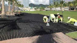
The final phase of the West I-40 stormwater management project was completed in December 2017 at a cost of $4.1 million. In addition to the volcano, the project involved the construction of 4,000 feet of channel, a 5.2-acre-foot detention pond, 6,000 feet of paved multi-use trail, and several public access points.
The volcano is expected to erupt a couple of times each year, usually during intense summer thunderstorms. To date, most of these eruptions might be better characterized as “oozes” as the flows haven’t been sufficient to cause an eruption of significant height. The hydraulic modeling showed that during a 100-year storm event, water from the volcano will erupt to a height of 16 feet above the top of the volcano. This hasn’t happened yet, but it will occur sooner or later; water wonks and engineers throughout the region can hardly wait.
The AMAFCA Snowman

Each summer AMAFCA’s field crews start scouting the watershed for the largest tumbleweeds, more properly known as Russian Thistle, to be found. When they are fully mature, and just before they dry up and blow away, the crew harvests the six largest and brings them back to the construction yard. Here, they’re spray painted white and three are wired together. Arms and facial features are added, and they’re dressed up with a scarf and hat to build two huge tumbleweed snowmen. The tumbleweeds at the base of 2018’s snowmen were 13 feet in diameter and the assembled snowmen were 12 feet tall.
During the first week of December, one of the snowmen is placed on a large platform in front of AMAFCA’s office next to the freeway interchange where it stoically waves to all who pass by. The public may know little about utilities like AMAFCA or what they do, but the snowmen are excellent ambassadors. In Albuquerque, the appearance of the AMAFCA tumbleweed snowman on the side of the freeway each December is widely celebrated by the community as the beginning of the Christmas holiday season.
The second snowman is placed on a 45-foot lowboy trailer and serves as the crown jewel of the AMAFCA float in the annual Albuquerque Christmas parade. As the parade proceeds through town down old historic Route 66 riders on the float have to continually remind concerned viewers along the parade route that the snowman by the freeway is still there. This is just his little brother.